Austin Street Parking Lots Visioning Workshop – Austin Street PARK VISIONING WORKSHOP – PLAN Charlestown – Jason Ruggerio


The Austin Street Park was shown in the BPDA Survey that is Pro Pier 5 Park. It was the second most wanted park location following the Austin Street Park prospect.

Map indicating suggested new park locations near Austin Street parking lots with green markers representing the size based on the number of responses.

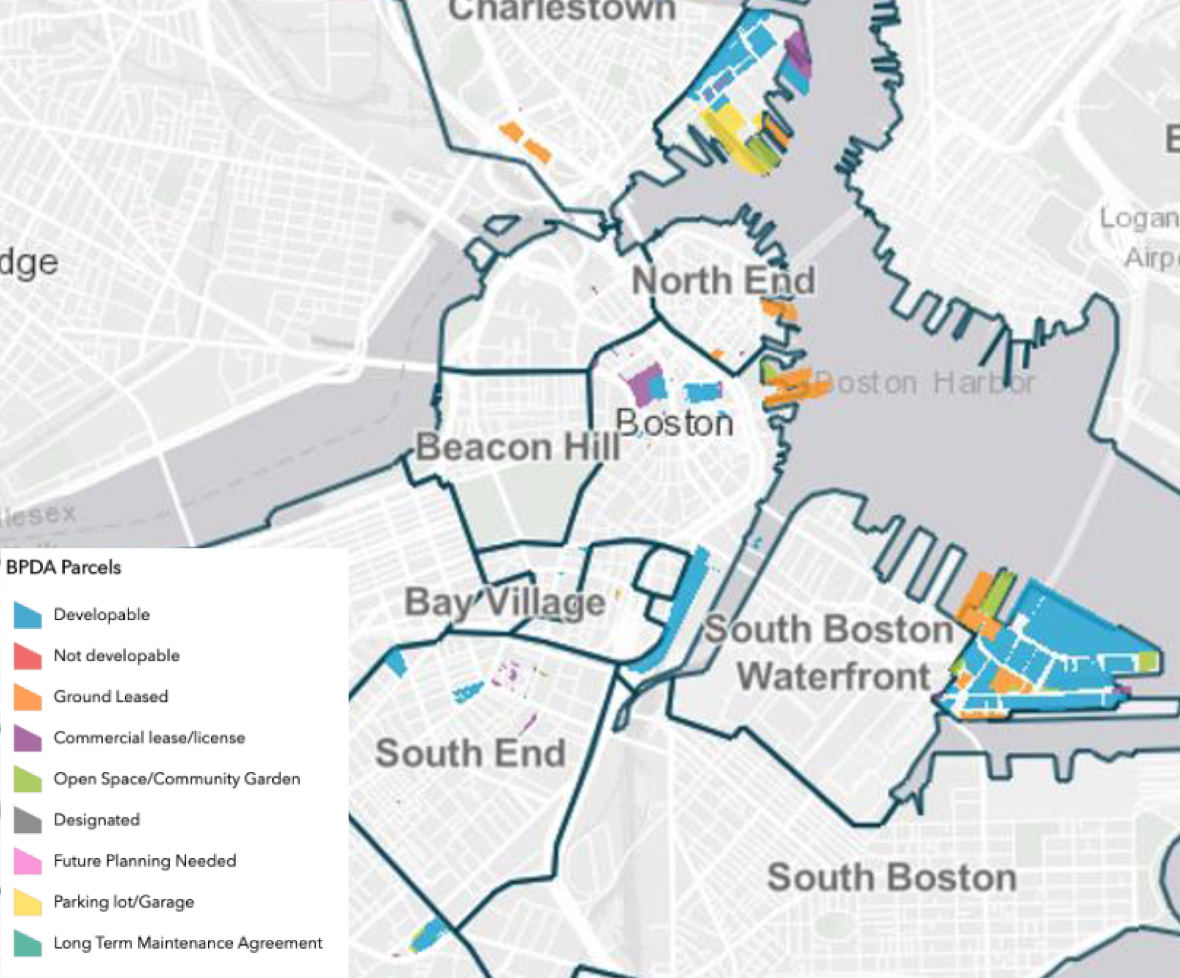
BPDA-Owned Parcels, note that Pier 5 is MARKED as being “Open Space/Community Garden”

A map displaying different BPDA-owned parcels with color-coded legends indicating their status, including developable, not developable, ground leased, commercial lease/license, open space/community garden, designated, future planning needed, parking lot/garage, and long term maintenance agreement.

Below is the “How does the BPDA lease land?” page of the below PDF SHOWING Pier 5 designated as “Open Space/Community Garden”.

Map of Boston highlighting BPDA parcels with various designations such as developable, not developable, and open space, including neighborhoods like the North End and South Boston Waterfront.
Map highlighting areas of Charlestown with color-coded zones

Discover more from Harbor Park Pier 5

Subscribe to get the latest posts sent to your email.

Leave a Reply

Discover more from Harbor Park Pier 5

Subscribe now to keep reading and get access to the full archive.

Continue reading