Terrains of Independence – Current Leventhal Exhibit


https://www.leventhalmap.org/digital-exhibitions/terrains-of-independence/#cover-content

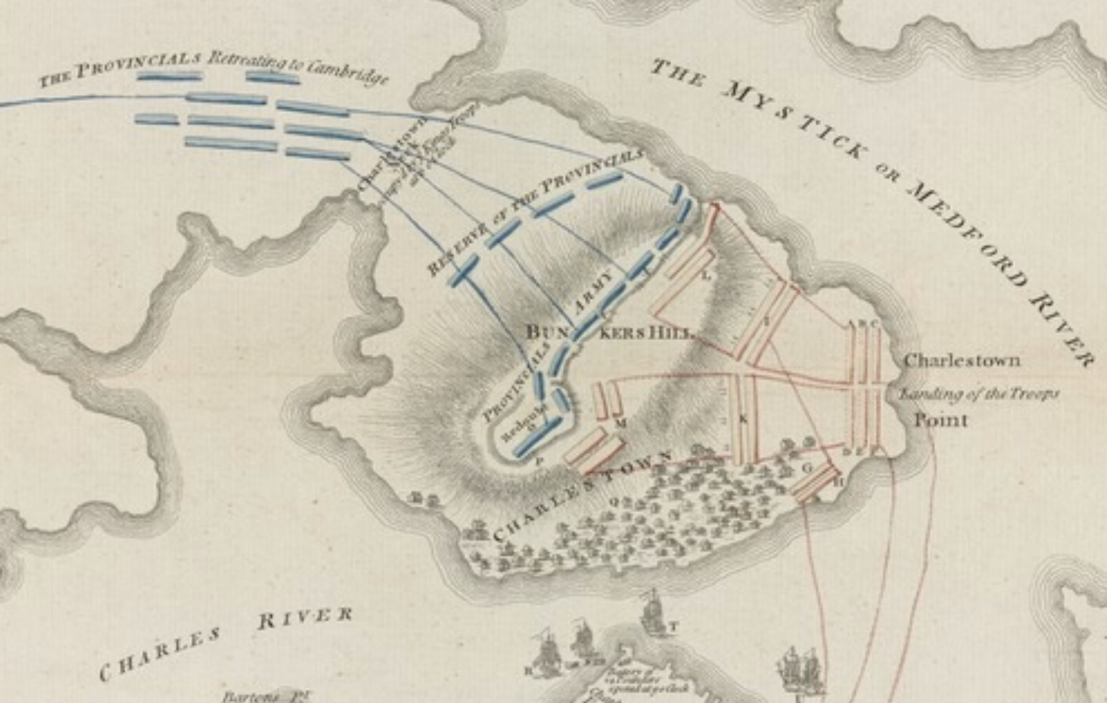
The American Revolution is a profoundly place-based story. In 1775, war ignited in Boston and its surrounding towns, fueled by conflicts over trade, governance, and imperial authority.

But why here? What was it about Boston and Massachusetts that made the region such a tinderbox for revolutionary activity in the late eighteenth century?

Terrains of Independence is on display from April 2025 through March 2026 at the Leventhal Center gallery, located at the Central Library in Copley Square. Admission is free.

A historical map depicting the location of the Battle of Bunker Hill, showcasing geographical features, surrounding areas, and annotations related to the battle.
A historical map titled 'A Sketch of the Action between the British Forces and the American Provincials on the Heights of the Peninsula of Charlestown, the 17th of June 1775', depicting troop movements and key locations during the battle.
A historical map of Boston and its surrounding areas, created by Richard Williams in 1776, depicting locations significant to the American Revolution.

Plan your visit or subscribe to our mailing list


Discover more from Harbor Park Pier 5

Subscribe to get the latest posts sent to your email.

Leave a Reply

Discover more from Harbor Park Pier 5

Subscribe now to keep reading and get access to the full archive.

Continue reading