We are taking action to adapt and protect Boston’s waterfront from coastal flooding from sea level rise and storms.
Between 2017-2022, we completed Coastal Resilience Plans for each of Boston’s five coastal neighborhoods, including Charlestown, Dorchester, Downtown/North End, East Boston, and South Boston. Today, we are implementing coastal resilience projects across the city’s waterfront to reduce coastal flood risk for Boston’s communities and safeguard our city’s future in the face of climate change.
Please visit the Coastal Resilience Planning webpage to learn more about the planning efforts that laid the groundwork for the action we are taking today.
COASTAL RESILIENCE PROJECT TRACKER
The Coastal Resilience Project Tracker is designed to provide an interactive overview of the City’s current efforts to mitigate and adapt to coastal flooding. The Coastal Resilience Project Tracker is more than just a tool for viewing active projects; it’s a platform for engagement and education. We encourage viewers to explore the tracker, learn about the city’s ongoing efforts, and find out how to get involved in making Boston a climate-resilient city. Together, we can ensure that Boston survives and thrives in the face of climate change.
https://experience.arcgis.com/experience/0e9719ff704d41aa9cc11a09c3378513
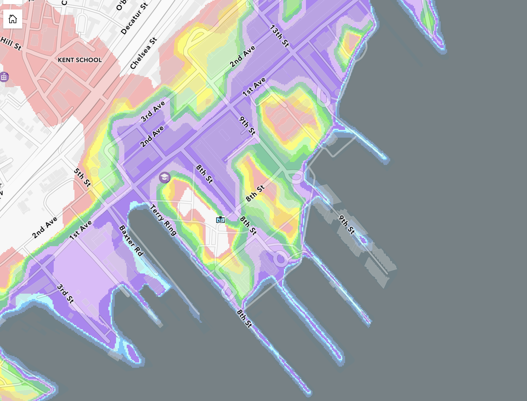
To use the interactive map, zoom in to explore active projects across Boston’s waterfront. The map legend shows the status of these active projects. Click on the highlighted areas on the map to learn more information about each project. The map displays extents of flooding produced from the Massachusetts Coast Flood Risk Model (MC-FRM), which is the Commonwealth of Massachusetts’ adopted flood projection model. The flooding shown accounts a 1% annual chance storm with sea level rise projections in 2030, due to continued high emissions of greenhouse gases and storm surges associated with coastal storms (hurricanes and nor’easters). Please note: All polygons are approximate and are subject to change.
IN PROGRESS PROJECTS
Charlestown Navy Yard and Little Mystic Channel
Led by the Planning Department, resilient design for the Charlestown Navy Yard and Little Mystic Channel launched in 2025.Ryan PlaygroundCharlestownLed by the Parks and Recreation Department, the final redesign of Ryan Playground was developed with input from the community with coastal resilience and active recreation as primary goals. The project is currently in construction.Long Wharf Coastal Flood Resilience Planning & Feasibility ProjectDowntown WaterfrontLed by the Planning Department, a design and engineering study is underway that will advance the coastal resilience plan for Long Wharf, which is one of the lowest-lying parts of the waterfront in the City.Resilient Fort Point Channel Infrastructure ProjectSouth BostonLed by the Planning Department, the Resilient Fort Point Channel Infrastructure Project is advancing the design proposed by Climate Ready Boston.Raymond L. Flynn Marine Park Flood Mitigation Planning & Feasibility StudySouth BostonLed by the Planning Department, the the project is designing flood protection strategies for the Raymond L. Flynn Marine Park.Resilient Moakley ParkSouth Boston / DorchesterLed by the Boston Parks and Recreation Department, the Resilient Moakley Park Plan includes recommendations for phased improvements within the Park and the areas to the north and south. The design is currently underway.Resilient Dorchester Waterfront Project at Tenean BeachDorchesterLed by the Planning Department and Office of Climate Resilience, the Project completed a 30% schematic design to address a near-term flood entry point at Tenean Beach. Final design and construction will be completed by the Commonwealth of Massachusetts.East Boston Resilient Waterfront Project at Lewis Street & Carlton WharfEast BostonLed by the Planning Department, the project completed a 30% schematic design to address flooding around Carlton Wharf and Lewis Mall. Advanced design is currently underway.Resilient Bennington Street And Fredericks Park ProjectEast BostonLed by the Office of Climate Resilience in partnership with the City of Revere, this project is advancing the design of coastal resilience strategies extending along Bennington Street in East Boston and Frederick’s Park in Revere.Resilient Border Street Waterfront ProjectEast BostonLed by the Office of Climate Resilience, the project aims to design coastal resilience infrastructure along the Border Street waterfront in East Boston in partnership with private landowners.
COMPLETED PROJECTS
Langone Park and Puopolo Playground
In 2020, the City completed a reconstruction project of the North End’s Langone Park and Puopolo Playground, which was designed with climate resilient features including an integrated seawall with seating on an elevated boardwalk.Martin’s ParkSouth BostonThe City of Boston Parks and Recreation Department oversaw the redesign of Martin’s Park on the South Boston waterfront, which opened in 2019. Martin’s Park is a climate-resilient park that provides a space for children of all abilities.McConnell ParkDorchesterIn July 2022, the City unveiled improvements to McConnell Park in Dorchester’s Savin Hill neighborhood, which included a renovation of the athletic facilities and implementation of climate resilient measures.Piers Park (Phase II)East BostonIn 2023, the Massachusetts Port Authority completed Piers Park (Phase II). The design for the 4.5-acre park includes key resiliency features to help protect the area from flooding and sea level rise.
Leave a Reply